About Fanore
The name comes from the Irish ‘Ór’ meaning sea coast and thus Fán Ór literally means ‘the declivity by the sea coast.’ A beautiful beach, noted for its edible seaweed. Some authorities hold that the name comes from Fán Óir, meaning golden slope of beach.
It is situated on the R477 to the south of Black Head and is a popular bathing place with a public recreation area. The village is quaint with a shop and a pub and further down the coast is Fitzpatricks, a general merchant and post office and O’Donoghue’s pub, which has music on Saturday nights.
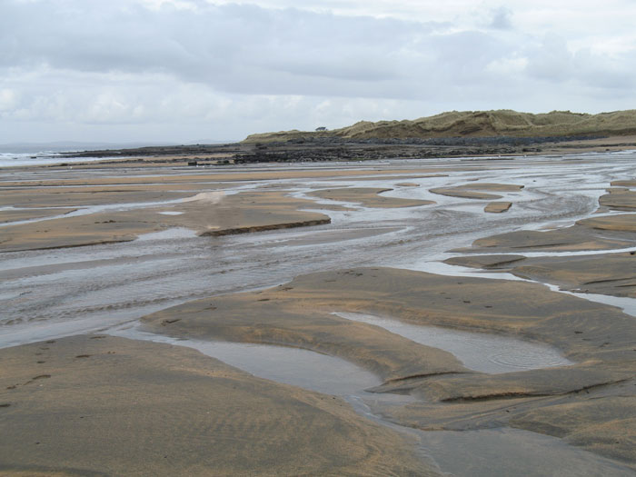
The Caher River enters the sea here and the sandhills area, known as the Rabbit Warren, are to the north of the river mouth. The site of a possibly middle stone age house has been excavated on the north bank.
Behind the beach a road goes inland and up the Khyber Pass or Caher River valley. It passes a village deserted since the days of the famine.
South of Fanore rises Slieve Elva, 345m and pierced by the cave of Pollnagollum, which is more than four miles in length.
Fanore was home to Australian author Francis Stuart, who died February 2nd 2000.
Black Head Loop

Fanore
Co Clare
Additional Information
Trailhead: Fanore Beach Car Park, Fanore, Co. ClareServices: Fanore (1km) and Ballyvaughan (14km)
Dist/Time: 26km / 5hr-6hrs
Difficulty: Hard
Terrain: Green roads, tracks and mountain paths
To Suit: Higher than average level of fitness
Map available in 'Other Information'
Downloads:-
Getting Here
- Bus Eireann 350 (Galway-Kinvarra-Doolin-Cliffs of Moher-Ennis)
- Clare Bus NA6 - Ballyvaughan - Lisdoonvarna - Ennistymon (Route NA6 - Ballyvaughan - Lisdoonvarna - Ennistymon)
Caher Valley Loop

Fanore
Co Clare
Additional Information
Trailhead: Fanore Beach Carpark, Co. ClareServices: Fanore, Co. Clare
Dist/Time: 14.5km/3-4hrs
Difficulty: Moderate
Terrain: Mix of minor roadways and green roads
To Suit: Medium level of fitness
Map available in 'Other Information'
Downloads:-
Getting Here
- Bus Eireann 350 (Galway-Kinvarra-Doolin-Cliffs of Moher-Ennis)
- Clare Bus NA6 - Ballyvaughan - Lisdoonvarna - Ennistymon (Route NA6 - Ballyvaughan - Lisdoonvarna - Ennistymon)
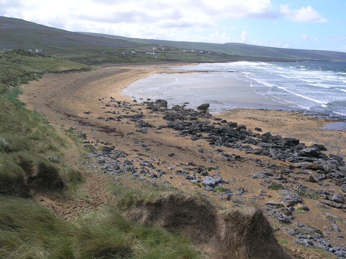
Fanore Beach

Fanore
Co. Clare
Additional Information
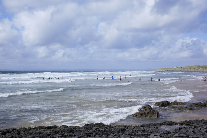
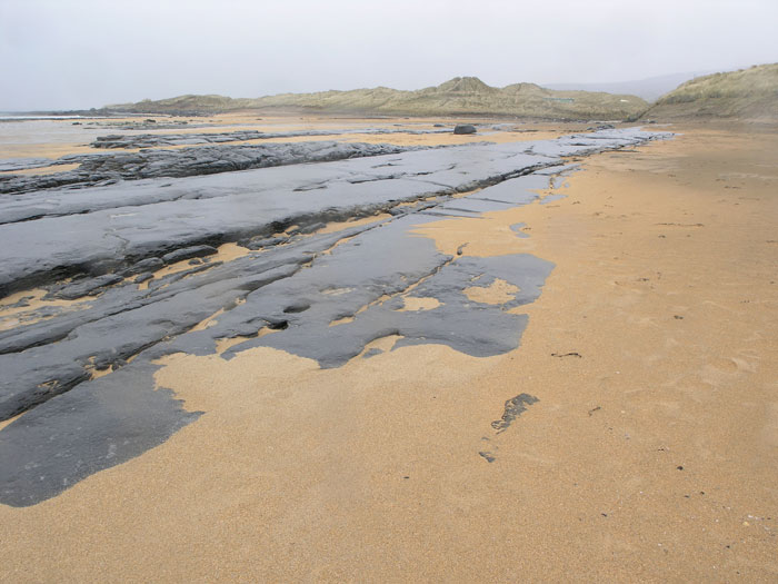
Fanore has a large sandy beach and extensive sand dune system. It is very popular with walkers, swimmers and surfers. Surfers can find a haven here as an alternative to the very busy Lahinch.From Fanore beach the Burren is in easy walking distance. Designated walking routes are Caher Valley Loop Walk, Fanore to Ballyvaughan Trek and the Burren Way. Maps of these routes are in 'Other information'
Fanore Beach is a Geosite.
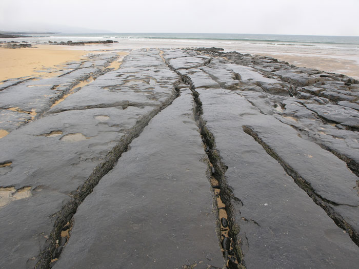
'Golden sand dunes, storm beaches of boulders stacked together by powerful waves, rocks rich in ancient marine fossils and smooth lime encrusted stones in the river bed of the Caher river – the only surface river in the northern Burren, are all to be discovered at Fanore Beach. Together with its diversity of flora, birdlife, butterflies and moths – and evidence of prehistoric hunters-gatherers living amongst the dunes, it is easy to understand why this beach is a Special Area of Conservation.'
Downloads:-
Getting Here
- Bus Eireann 350 (Galway-Kinvarra-Doolin-Cliffs of Moher-Ennis)
- Clare Bus NA6 - Ballyvaughan - Lisdoonvarna - Ennistymon (Route NA6 - Ballyvaughan - Lisdoonvarna - Ennistymon)
Fanore to Ballyvaughan

Fanore
Co Clare
Additional Information
Trailhead: Car Park Fanore BeachServices: Full services are available at Fanore and Ballyvaughan
Distance: 21Km
Time: 5 – 6hrs
Difficulty: Difficult to Hard
Terrain: Green roads, minor roadways, woodland tracks.
To Suit: High levels of fitness
Map available in 'Other Information'
Downloads:-
Getting Here
- Bus Eireann 350 (Galway-Kinvarra-Doolin-Cliffs of Moher-Ennis)
- Clare Bus NA6 - Ballyvaughan - Lisdoonvarna - Ennistymon (Route NA6 - Ballyvaughan - Lisdoonvarna - Ennistymon)
Post office

Craggagh
Fanore
Co. Clare
Getting Here
- Bus Eireann 350 (Galway-Kinvarra-Doolin-Cliffs of Moher-Ennis)
- Clare Bus NA6 - Ballyvaughan - Lisdoonvarna - Ennistymon (Route NA6 - Ballyvaughan - Lisdoonvarna - Ennistymon)
Saint Patrick's Church

Murrough
Fanore
Co. Clare
Additional Information
For mass time, please go to the websiteGetting Here
- Bus Eireann 350 (Galway-Kinvarra-Doolin-Cliffs of Moher-Ennis)
- Clare Bus NA6 - Ballyvaughan - Lisdoonvarna - Ennistymon (Route NA6 - Ballyvaughan - Lisdoonvarna - Ennistymon)