The landscape of the Geopark is a mosaic of specialised natural habitats, hosting unique and varied flora and fauna. Nestled within these habitats is a vast array of archaeological, architectural and cultural heritage sites. We want to maintain this unique landscape while encouraging visitors to view and enjoy it. Through taking a partnership approach involving the management agencies and landowners of the region we are looking to determine the best future management options for these sites.
Developing Integrated Management Practices at Heritage Sites
Our natural, built and cultural heritage is one of our regions most important draws for tourism. Safeguarding our heritage not only ensures it survives into the future but it also ensures that it is available for the enjoyment of local people and visitors today. Our heritage tells the story of where we have come from and why we live the way we do, it tells the story of our customs, and culture past and present. It’s cultural value is significant. We are working with our partners to determine the best future management options for the heritage sites of the region.
Piloting and assessing

Demonstrations site locations
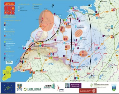
Seven demonstration sites within the Burren have been selected to design and test integrated management approaches. The selected sites demonstrate a wide geographical spread of diverse monuments and habitats, various management regimes and ownership. They are all popular visitor destinations, attracting varying types and numbers of visitors.
The seven selected sites which sit across three zones are:
- Blackhead / Fanore
- An Rath/Cahermore
- Aillwee Cave
- Slieve Carran Nature Reserve
- Poulnabrone
- Carran Church
- The Burren National Park
A Partnership approach
Through a partnership approach involving the management agencies – Office of Public Works (OPW), National Monument Service (NMS), National Parks and Wildlife Service (NPWS) and Clare County Council (CCC) – and the landowners, each site has been assessed in terms of its intrinsic heritage value and condition to provide baseline information. Visitor observation studies have been undertaken to determine how visitors behave and move through a site and how their actions can cause impact. Visitor numbers to each site are being recorded on an hourly and daily basis, providing vital baseline detail that was not previously available. This in-depth site analysis had led to the identification of the sensitive pressure points of each site and visitor impact issues. A plan of work, which was implemented in 2016, was developed to tackle the identified issues. It includes:
- Management of visitor impact on archaeological sites in conjunction with the OPW and NMS,
- Development of a monitoring scheme for management of visitor impact on walking trails in conjunction with NPWS and the Rural Recreation Officer,
- development of long term dune protection and visitor management plan at Fanore in conjunction with CCC;
- Development of least restrictive access (physical and intellectual) to sites for all users in conjunction with the National Disability Authority, the Brothers of Charity Ennis and site managers;
- Exploration o f provision of parking and improved access at An Rath/Cahermore in conjunction with OPW, NMS, CCC and landowner
- Conservation work at Carran Church and improved directional signage
- Provision of universally accessible interpretation at all sites.
- Development of a monitoring scheme to measure visitor impacts and changes at each site