Geosites and Discovery Points
There’s nowhere in the world quite like the Burren. And there are so many unique places nestled within the area. There are nine Geosites you can visit – areas of particular geological significance – in the Burren Geopark, each with its own on-site visitor and interpretation information.
The Burren Geopark is also home to 7 Wild Atlantic Way Discovery Points, the cliffs of Moher also being a Wild Atlantic Way Signiture point.
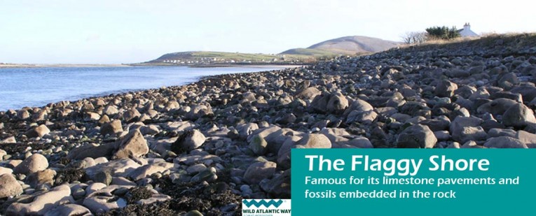
Flaggy Shore – Geosite and Wild Atlantic Way Discovery Point
The Flaggy Shore is one of the most northerly parts of County stretching from the village of New Quay to Finvarra Point. Flaggy Shore is one of nine sites of geological importance that form the basis of the Burren and Cliffs of Moher Geopark. Famous for its limestone pavements, fossils embedded in the rock, including sculptured rocks along the shore called ‘Biokarst’. A paved road runs along the shore making it ideal for walkers of all ability and age. Find out more
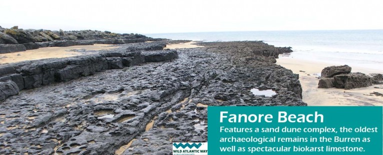
Fanore Beach – Geosite and Wild Atlantic Way Discovery Point
Fanore has a large sandy beach and extensive sand dune system. It is very popular with walkers, swimmers and surfers. The beach is located in close proximity to Fanore village which includes a coffee shop, pub, shop and campsite . The caravan park is located within the adjacent dunes and there is car-parking and an access road off the R477 to the beach. Find out more
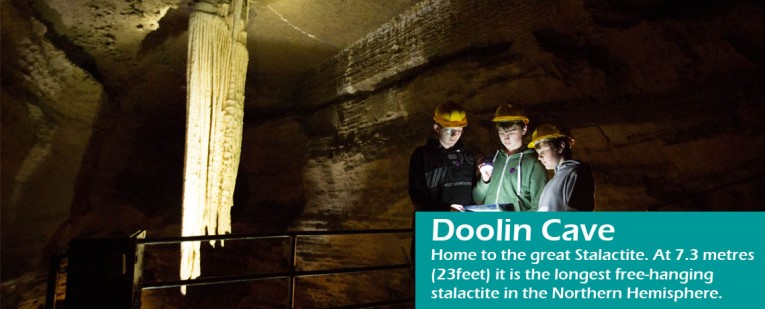
Doolin Cave – Geosite
Doolin Cave (also known as Pol an Ionain) is located beneath a limestone valley. The valley is now blanketed by glacial rocks and clays and probably initially formed during warmer periods before the last ice age. Doolin cave contains one of the longest stalactites in the world that is accessible to public visitors. Find out More
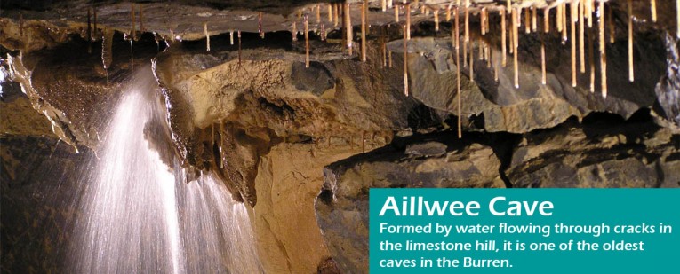
Aillwee Cave – Geosite
Aillwee Cave was first discovered in 1940 by local farmer Jack McGann who followed his dog into the cave. It wasn’t until 1973 that he told cavers about it and by 1977 the cave had been fully explored and mapped. Formed by water flowing through cracks in the limestone hill, it is one of the oldest caves in the Burren. Fine out more
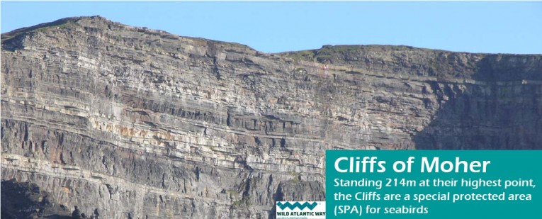
Cliffs of Moher – Geosite and Wild Atlantic Way Discovery Point
Standing 214m at their highest point, the Cliffs of Moher stretch along the Atlantic coast of County Clare. The Cliffs of Moher are one of Ireland’s most visited natural attractions. The Cliffs of Moher and Visitor Centre are open all year round. Highlights include over 800m of cliff edge paths and viewing areas, the gothic style 19th century O’Briens Tower near the highest point of the cliffs and the eco-friendly underground visitor centre building containing visitor services and facilities, gift shop, restaurant & coffee shop and the award winning Atlantic Edge Exhibition. Find out more
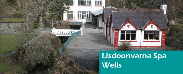
Lisdoonvarna Spa Wells – Geosite
The town of Lisdoonvarna is built on a geological unit known as the Clare Shales, which lie directly on top of the limestone which comprises most of the Burren. For over 200 years, the waters that flow from springs in the Clare Shales have attracted visitors for their curative properties. Find out more
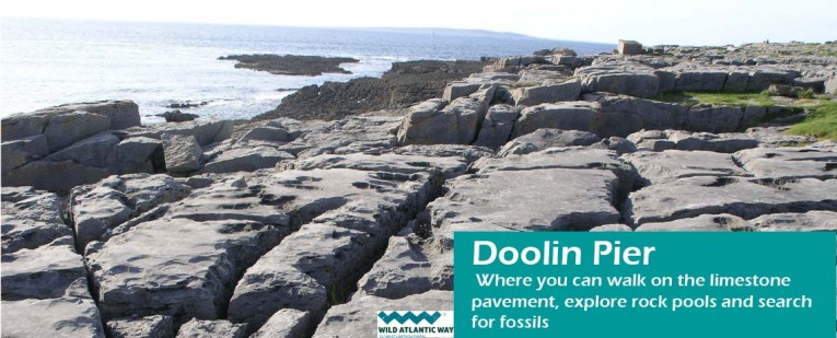
Doolin Pier – Geosite and Wild Atlantic Way Discovery Point
Doolin Pier is set against the rugged Atlantic Ocean and surrounded by the spectacular bare limestone landscape of the Burren. This discovery and embarkation point is in close proximity to Doolin village, a popular tourist destination that is renowned for its traditional Irish music. Doolin Pier is one of nine sites of geological importance that form the basis of the Burren and Cliffs of Moher Geopark. Find out more
Slieve Carran – Geosite
Slieve Carran Nature Reserve is managed by the National Parks and Wildlife Service, it is part of the East Burren Complex Special Area of Conservation.
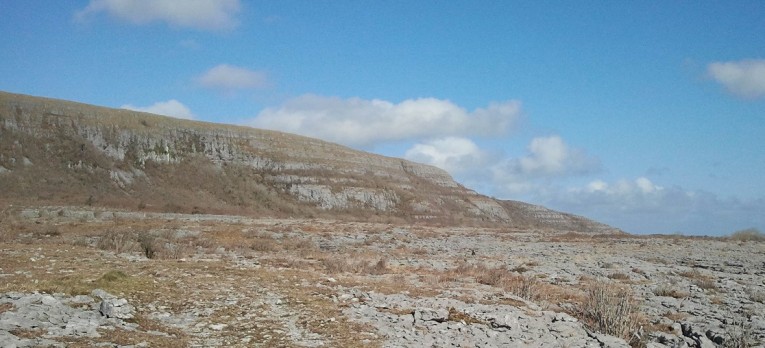
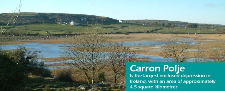
Carron Polje & Turlough – Geosite
A Polje is a large flat-bottomed valley feature of limestone regions formed by prolonged dissolution. The Carron Polje is the largest enclosed depression in Ireland, with an area of approximately 4.5 square kilometres. The “disappearing lake” or Turlough is the most noticeable part of the Polje. Find out more
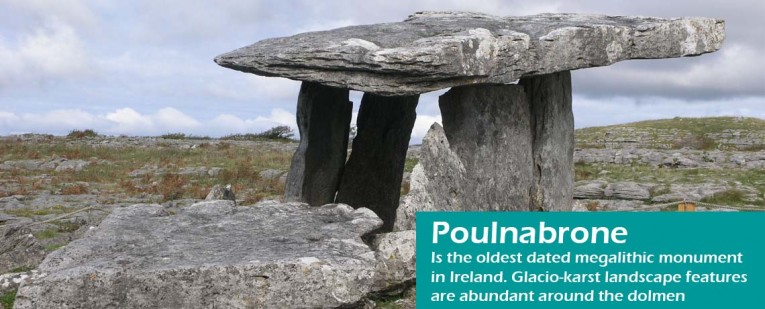
Poulnabrone – Geosite
Situated on the high Burren limestone plateau, Poulnabrone Dolmen is one of Ireland’s most iconic archaeological monuments and is the second-most visited location in the Burren, after the Cliffs of Moher. It is the oldest dated megalithic monument in Ireland. Find out more
